Parkhaven
ParkHaven adds a new piece of urban green to the city of Rotterdam. The existing quay along the Westzeedijk, marked by the iconic Euromast tower designed by Hugh Maaskant in the 1950s, is being transformed into a generous and accessible public landscape – one that connects the quay, the Scheepvaartkwartier, Het Park, and the western neighbourhoods of Rotterdam. The plan is aimed at recreational visitors and new residents alike.
Location
Rotterdam (The Netherlands)
Type
Urban design
Site
90.000 m²
Program
65.000 m² GFA (650 dwellings, 350 parking and commercial program)
Client
Parkhaven Partners (Ontwikkelcombinatie Heijmans Vastgoed en TBI Ondernemingen: ERA Contour en J.P. van Eesteren)
Design Partners
Juurlink & Geluk (CULD), INBO
Collaborators
Goudstikker De Vries, Waterpas Civiel Adviesbureau
contractor
ERA Contour, J.P. van Eesteren, Heijmans Vastgoed
Status
Design phase (2019 – Ongoing)
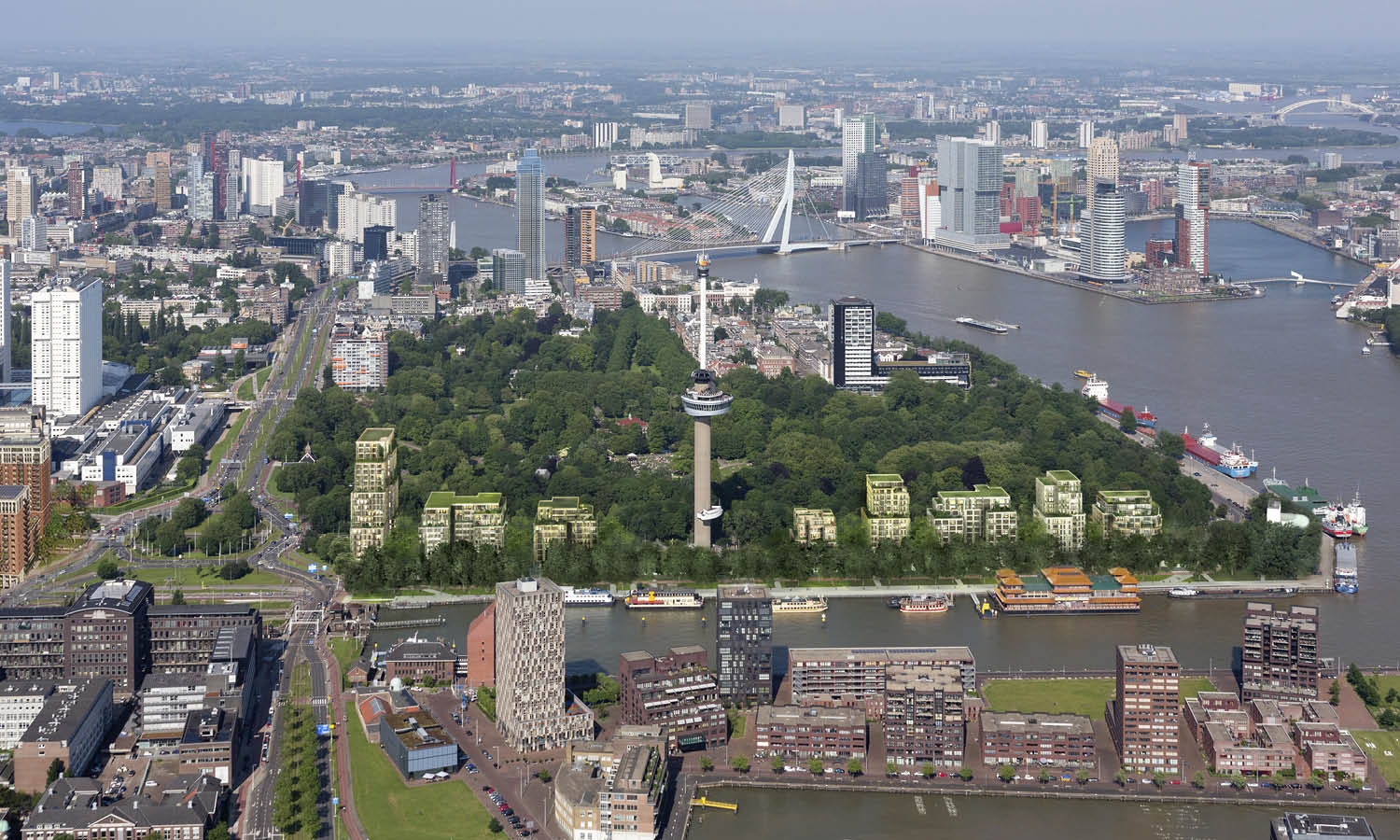
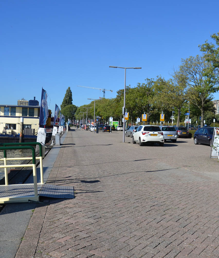
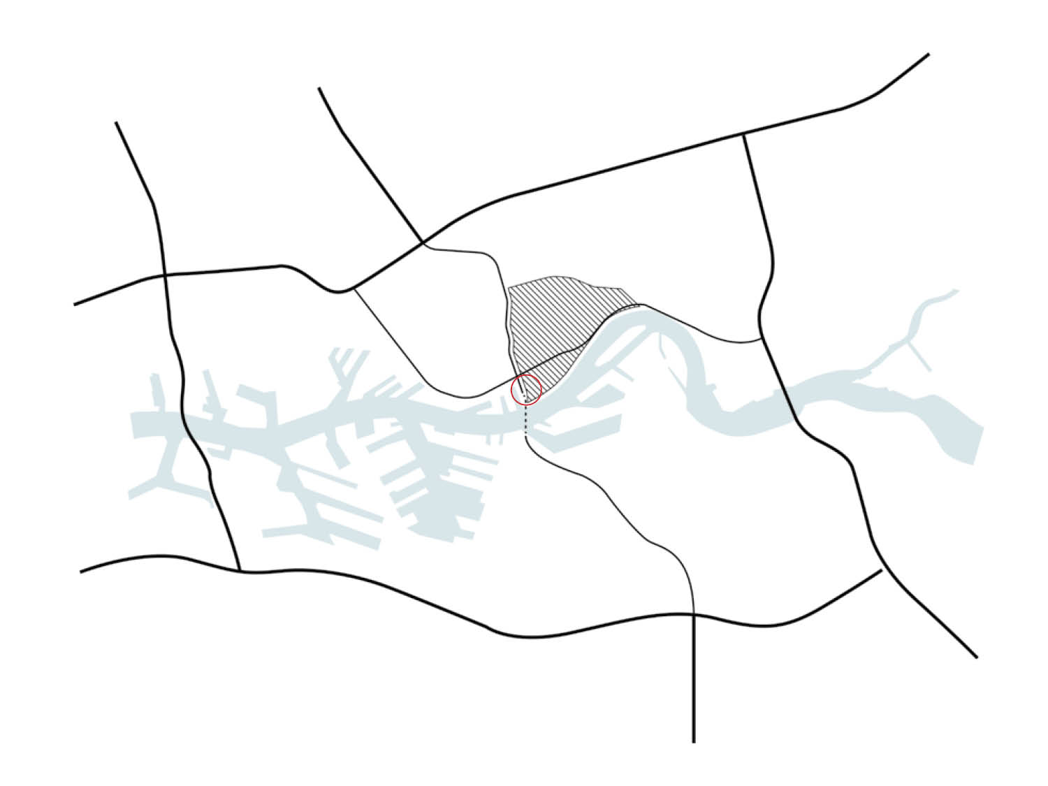
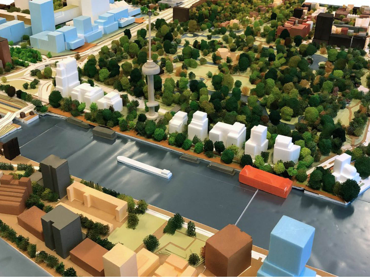
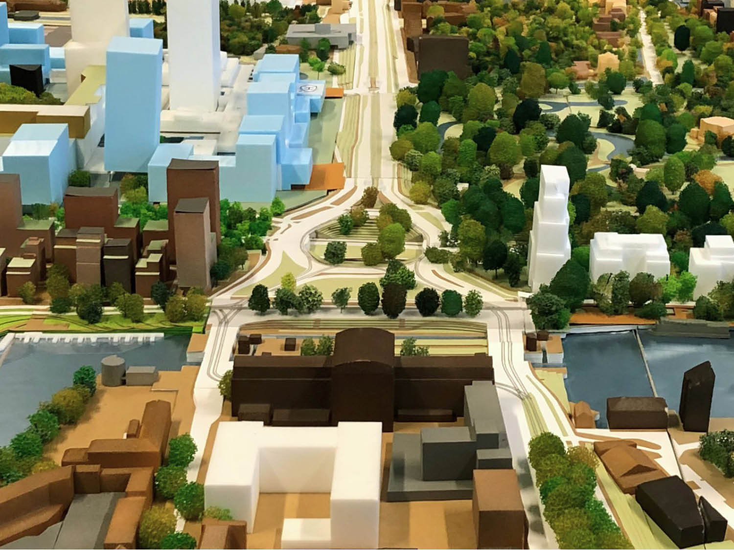
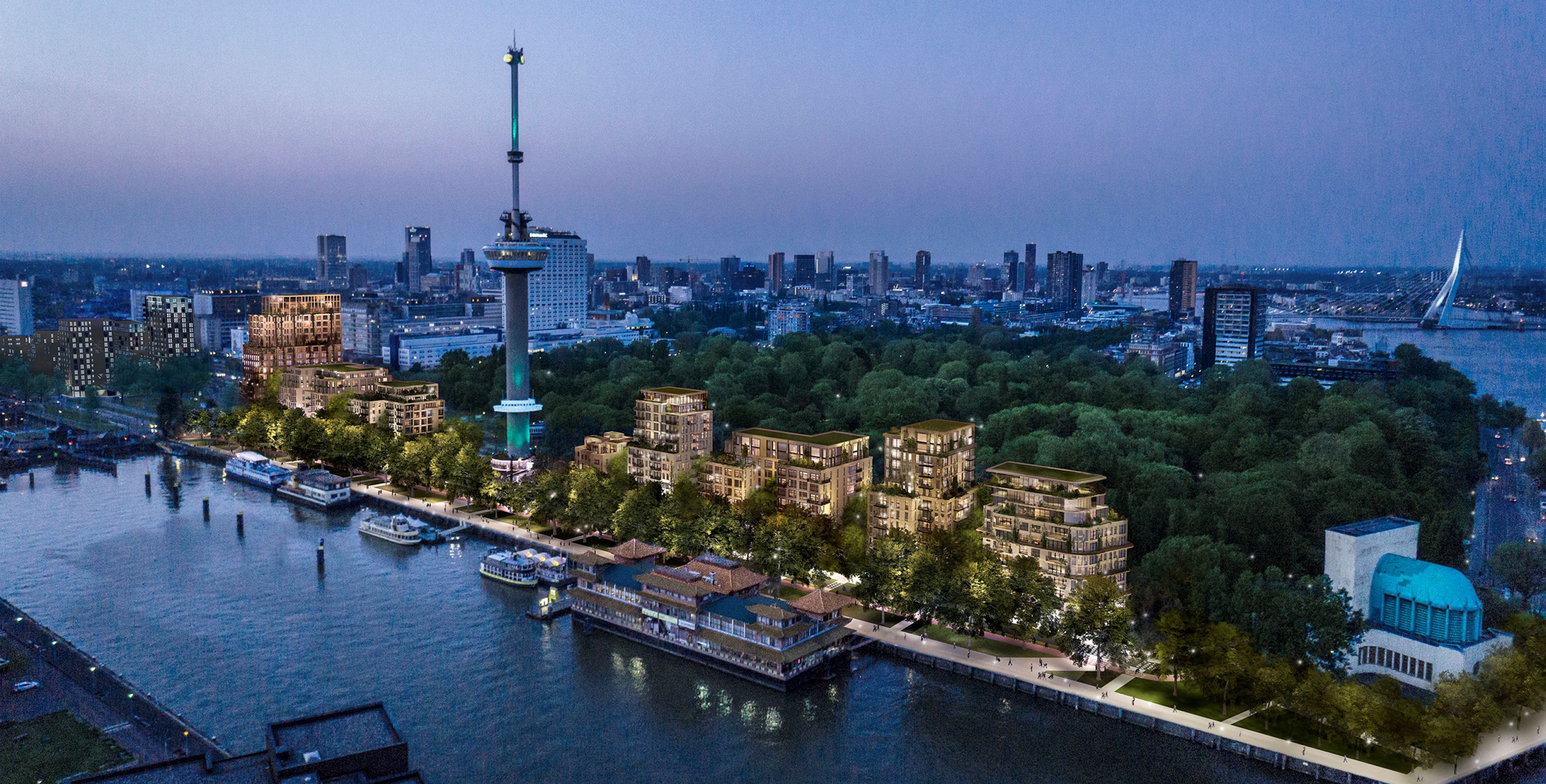
The quay has its origins as a working harbour, and later became little more than a parking area – a residual strip caught between the Maastunnel traverse, Het Park, and the river. Despite its exceptional location, the site never fulfilled its role as a meaningful part of the city's public realm. ParkHaven changes that. In the tradition of Rotterdam's most significant urban developments, the plan restores the pride and grandeur of the Euromast and its surroundings, giving the tower a renewed address in the city and forming a natural extension of the urban fabric around it. The new buildings make their presence felt at multiple scales – in the immediate surroundings, across the broader landscape of the river banks, and in the image of the city as a whole.
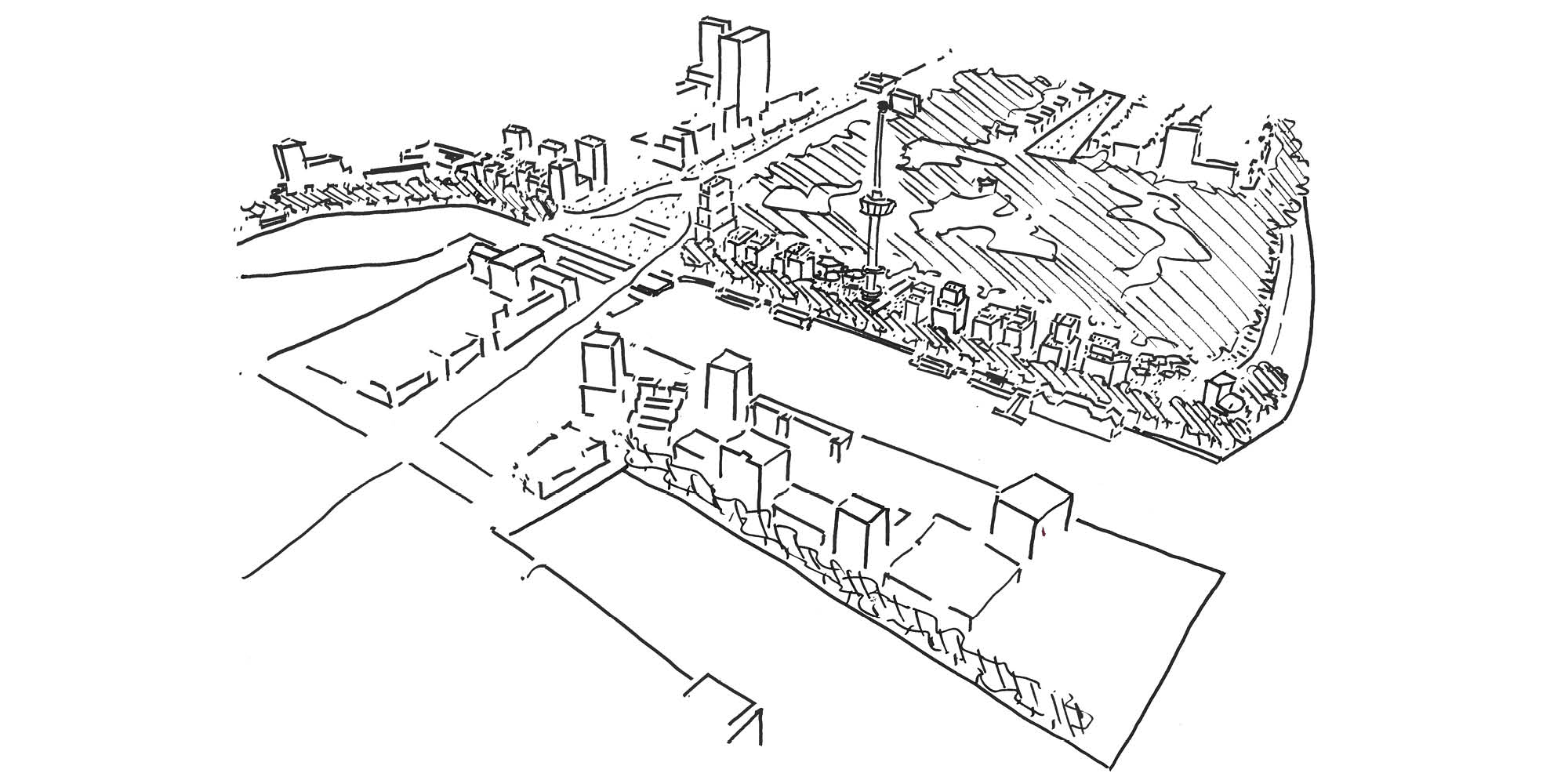
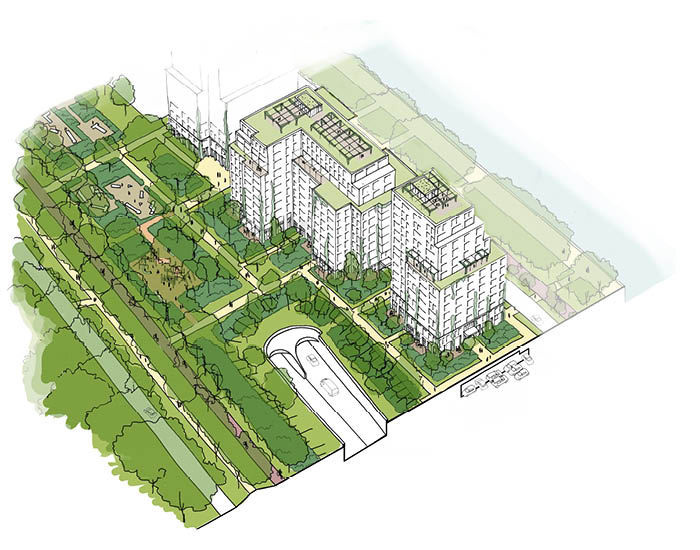
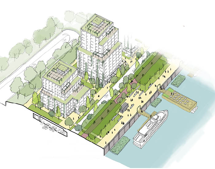
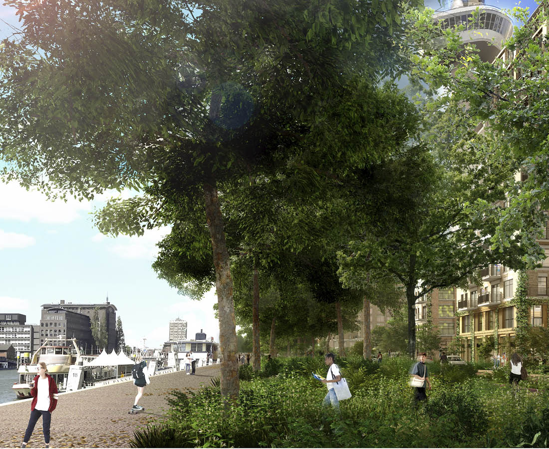
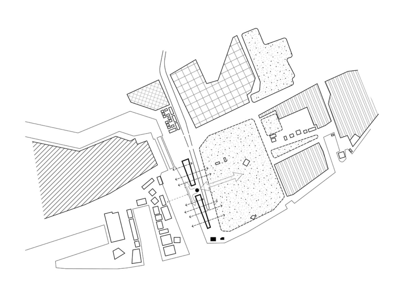
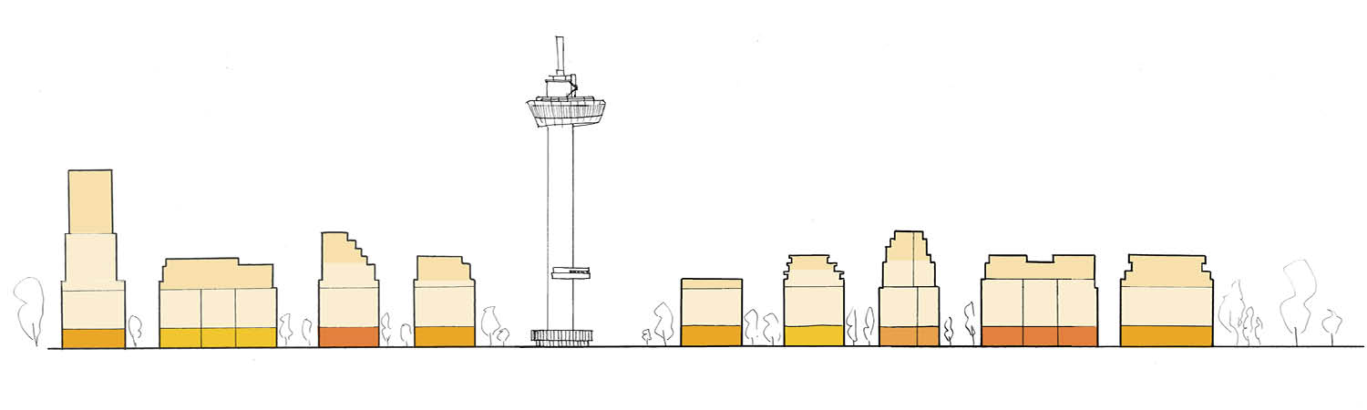
The plan has a clear double orientation. To the west, the quay becomes an intimate and joyful green waterfront – a place that can be used and enjoyed in many different ways, forming part of the continuous landscape of Rotterdam's public quaysides. To the east, the buildings present a quieter face to Het Park, with an elegant raised residential and recreational plinth along a shaded pedestrian and cycling route. Eight residential buildings are placed along the full 600-metre length of the strip, from the Droogleever Fortuynplein in the north to the Parkkade in the south. Their footprints follow the existing hardscape, freeing the ground level for a connected, ecologically richer public landscape.
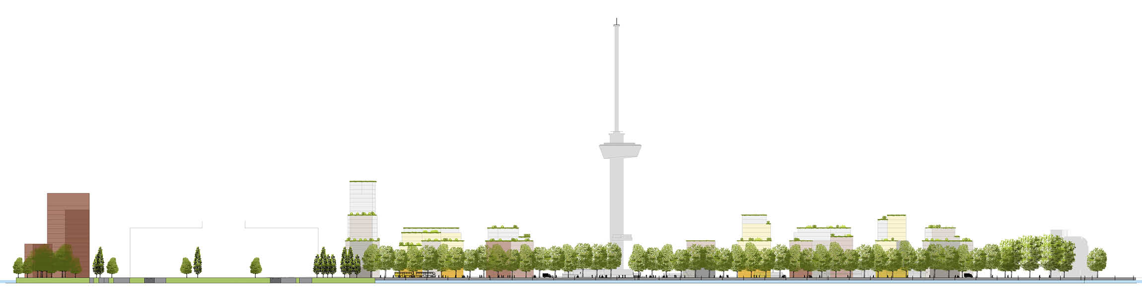
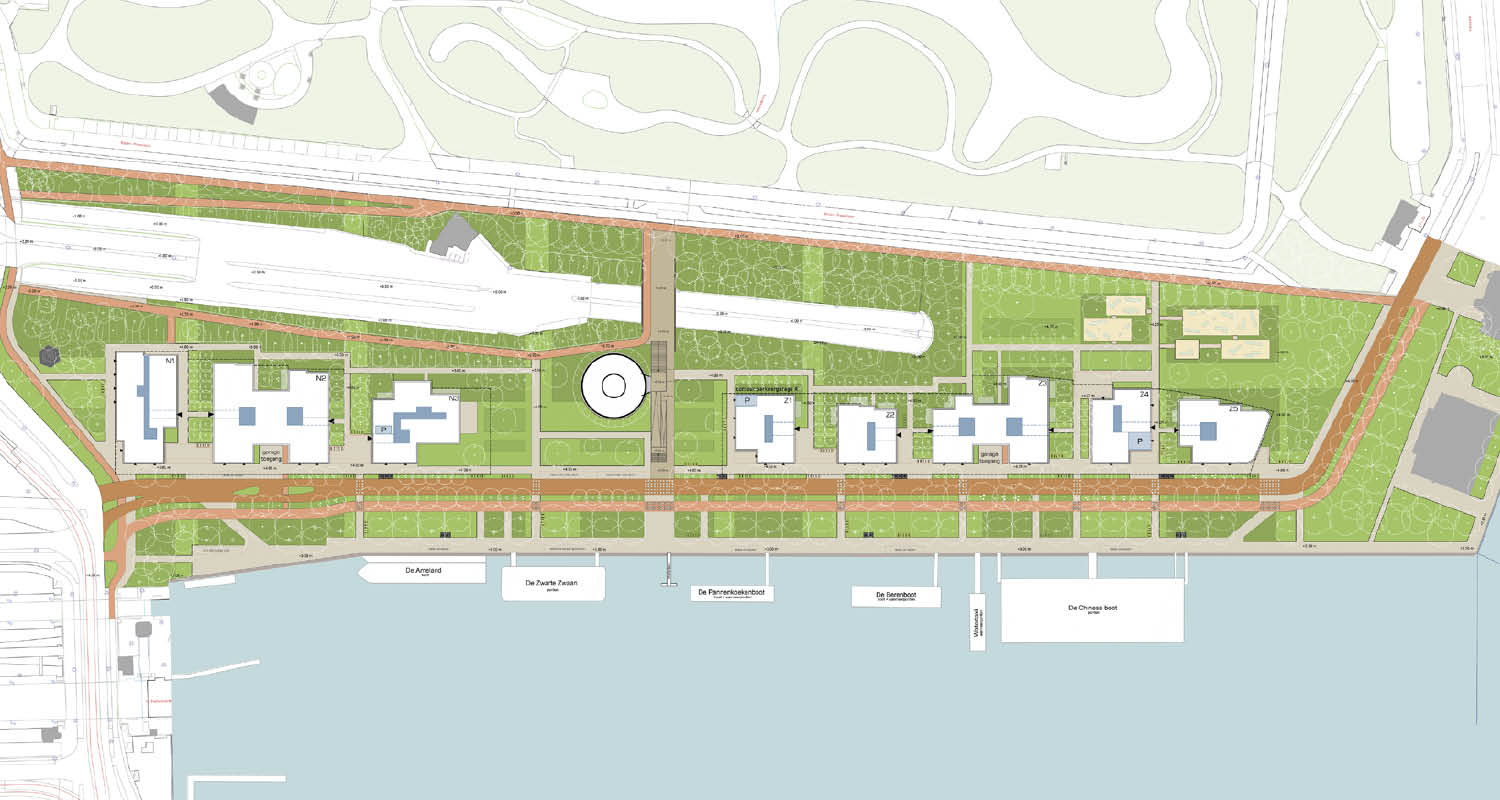
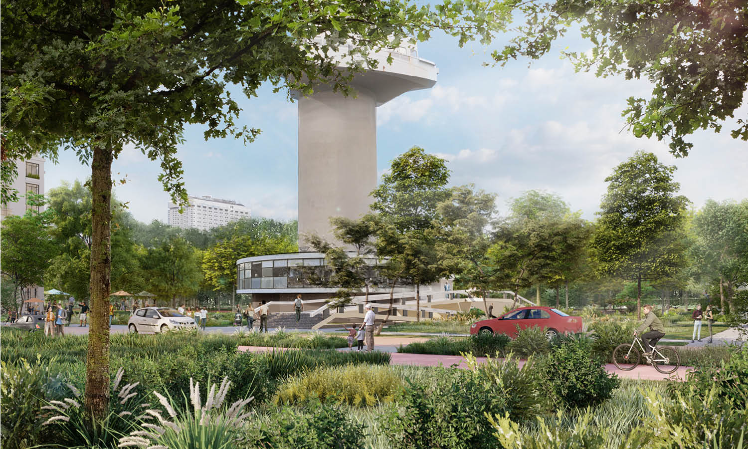
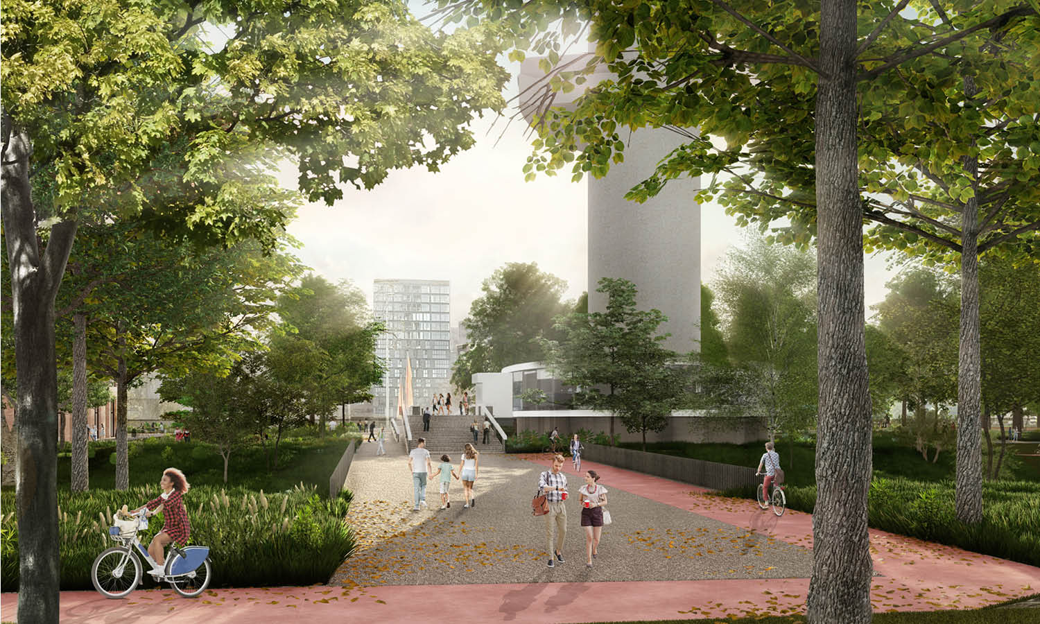
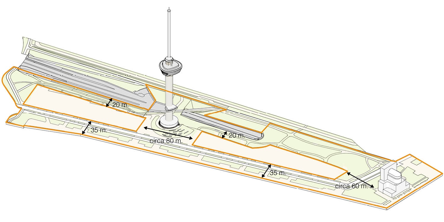
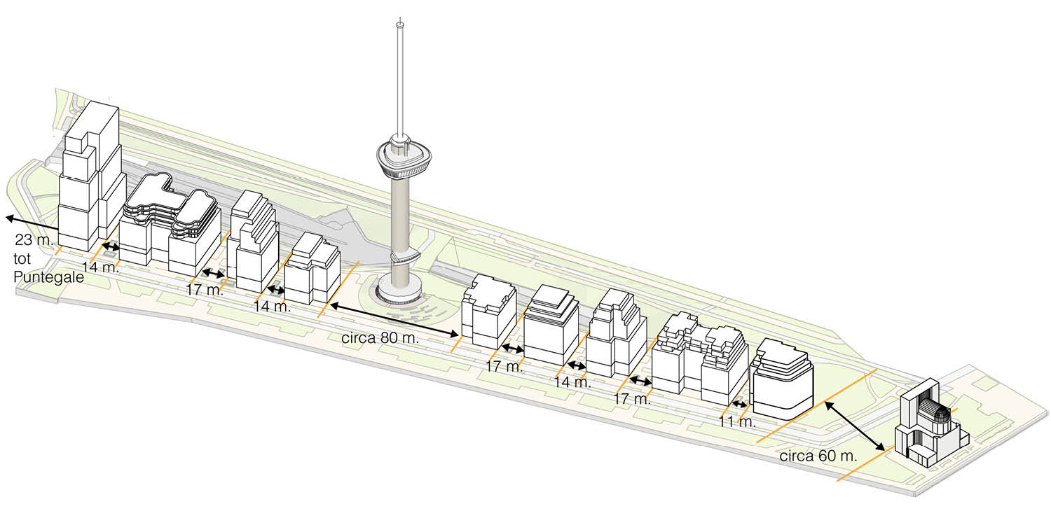
The ensemble is carefully calibrated around the Euromast: a broad open space of 105 metres is preserved around the tower, and the heights and sightlines of the buildings are tuned to keep it visible and legible within the city. A new pedestrian and cycling bridge near the Euromast will link the quay directly to Het Park. Existing amenities along the quay are retained within the new programme.
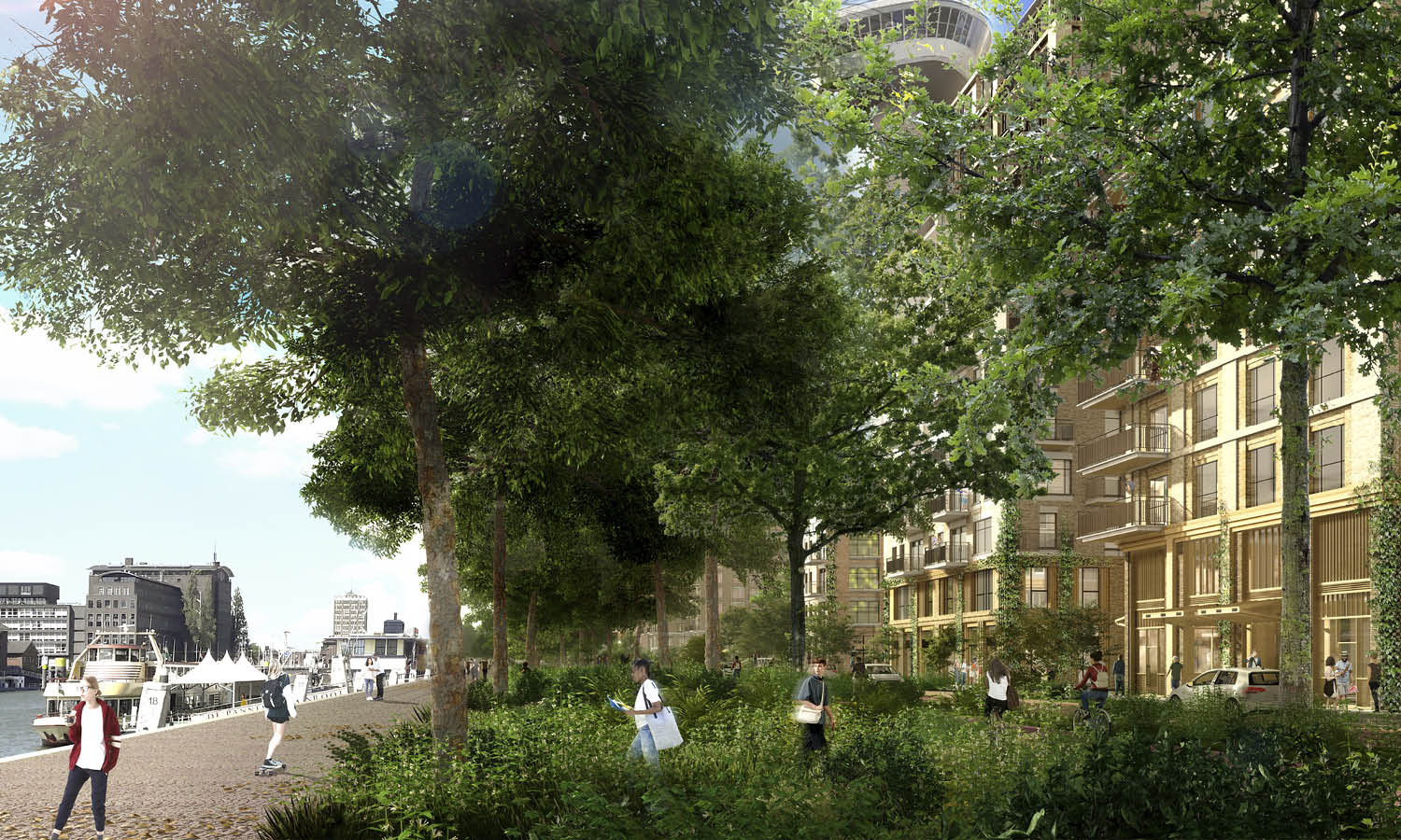
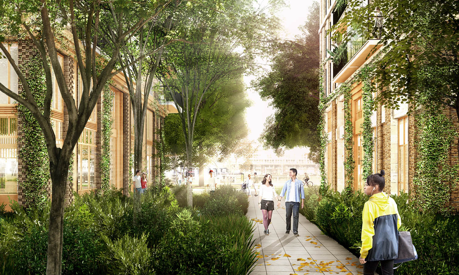
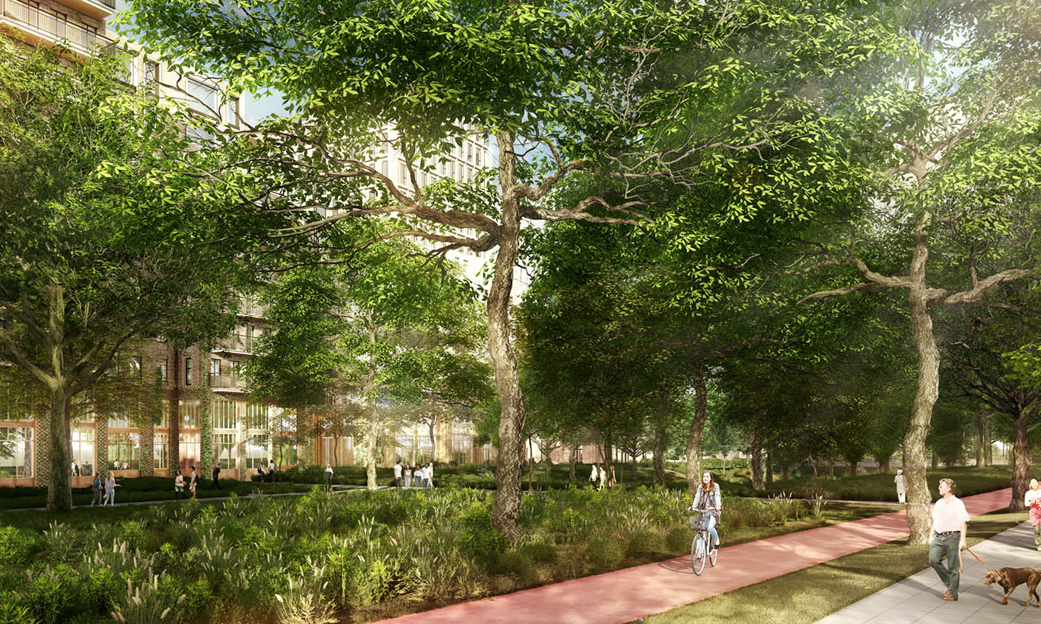
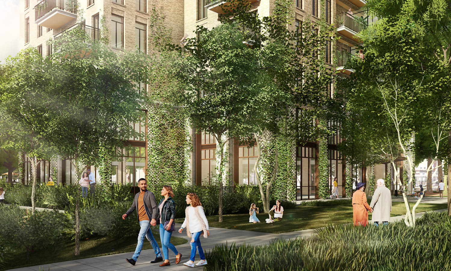
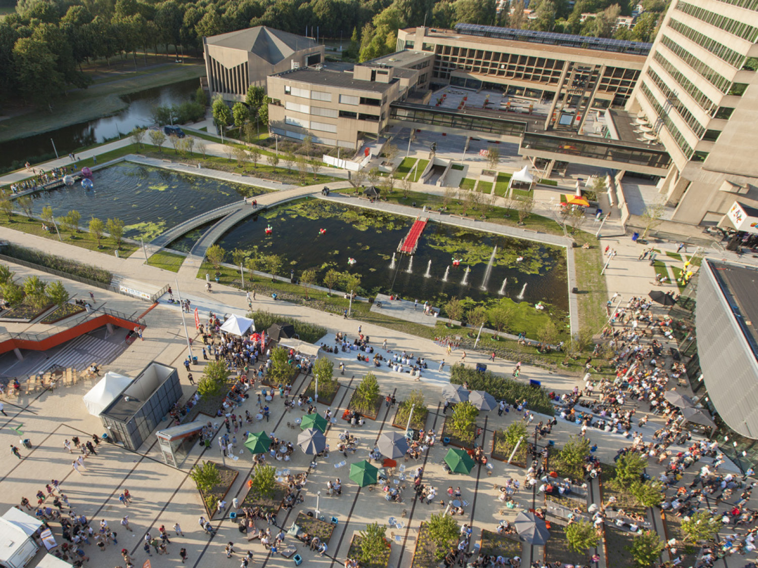
Between the buildings, intimate green courtyards and alleyways create a fine-grained network of outdoor spaces that invite residents and visitors to slow down and dwell. This layered green quality – from the animated quayside to the quieter inner spaces – is designed to complement rather than compete with the English landscape character of Het Park, functioning as an ecological edge and transition zone that connects the Coolhavenpark, the Museumpark, and the river Maas into a continuous green network.
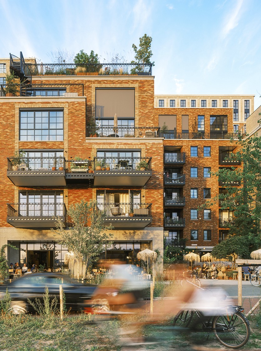
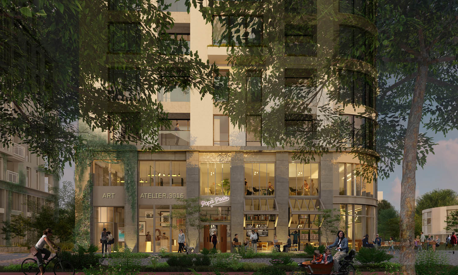
Active plinths along the quay accommodate local shops, offices, workshops, and educational and medical facilities, ensuring a lively ground level throughout the day. Parking is resolved discreetly under the building blocks, keeping the ground level entirely free for people, planting, and public life.
Active plinths along the quay accommodate local shops, offices, workshops, and educational and medical facilities, ensuring a lively ground level throughout the day. Parking is resolved discreetly under the building blocks, keeping the ground level entirely free for people, planting, and public life.
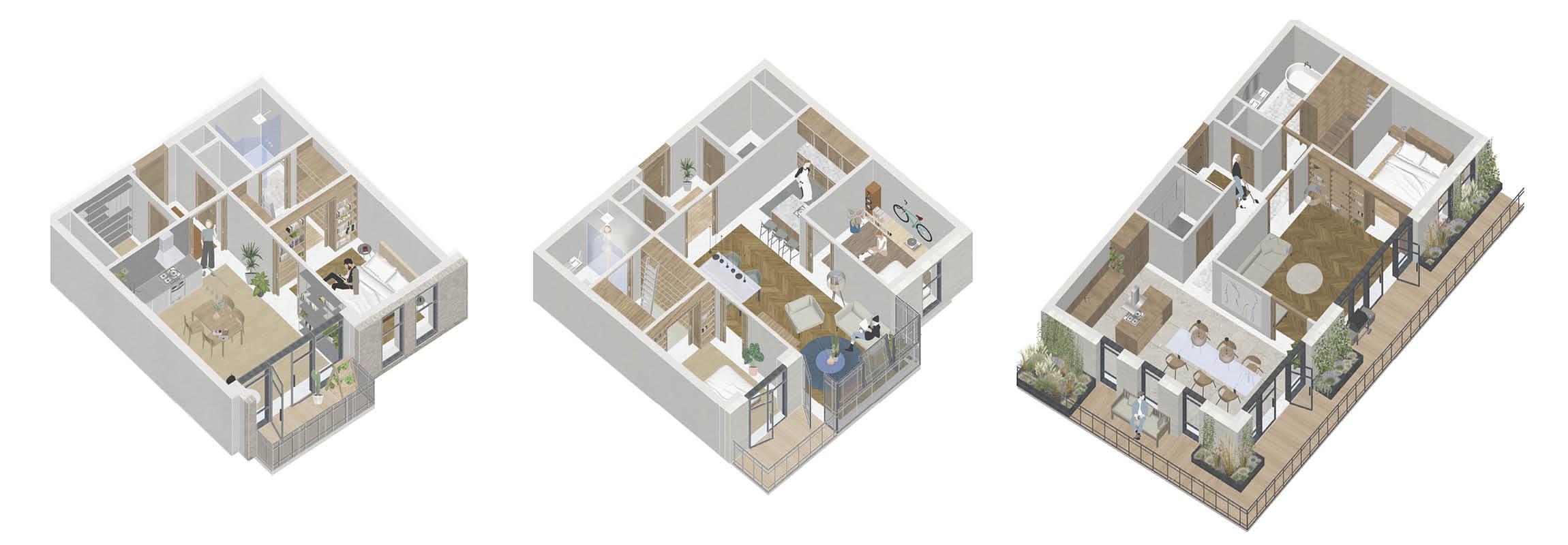
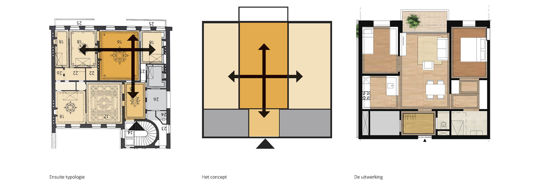
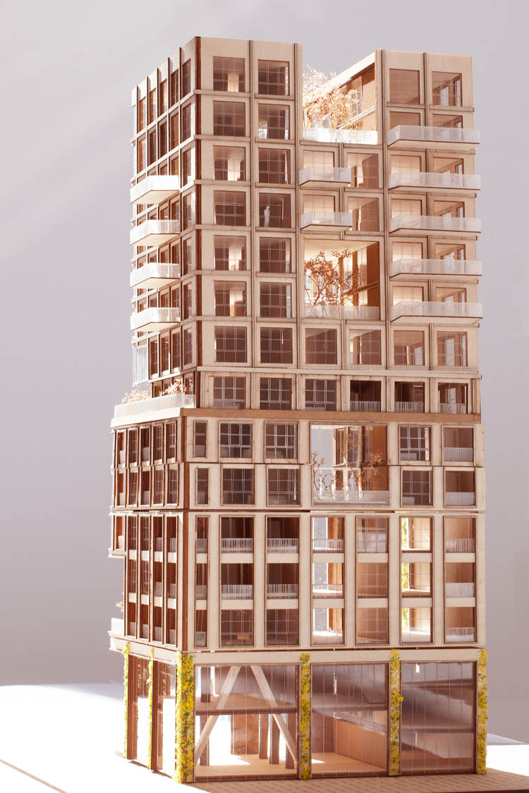
The buildings bring together a wide range of housing typologies based on the en-suite principle, integrating social housing, low and high rent, and owner-occupied dwellings within a single, inclusive urban community.
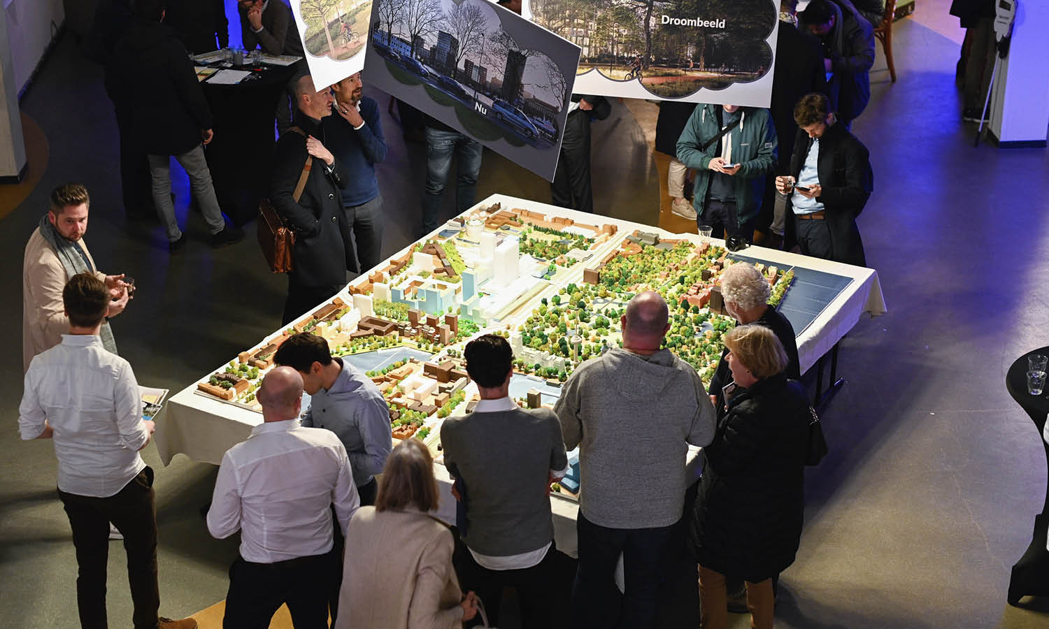
The design process was shaped in close dialogue with the city and its inhabitants. Through public information evenings, residents and stakeholders were invited to share their vision for the area – including their dream images of living along this stretch of waterfront. A large-scale model of the surroundings was built to make the spatial proposals tangible and to root the conversations in the specific context of this cherished part of Rotterdam. These exchanges informed the range and character of the housing typologies developed for the plan.
The first three buildings of the plan, seen from the Westzeedijk, are currently under development.